Blog

Info

Drive Through Avenue

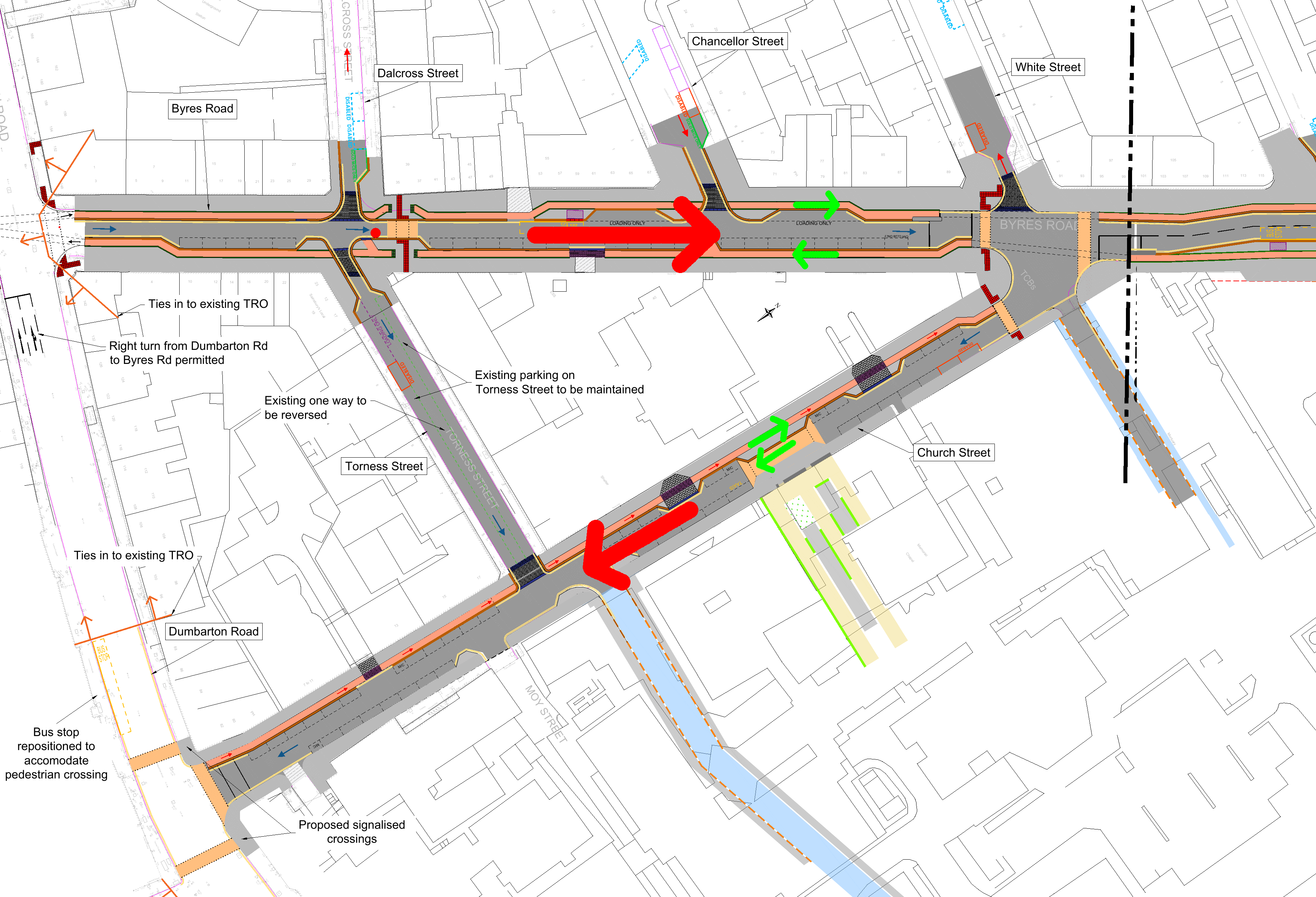
What’s not talked about

Now that the University Avenue construction works are nearing completion, it’s worth assessing how we got here and what can be done.

One of the original University Avenue project’s aims were:

“Prioritise pedestrian and cycle movement along University Avenue through design. This may include reallocation of road space to pedestrians/cyclists and surface treatments”

from 2014 Gilmorehill Campus Development Framework

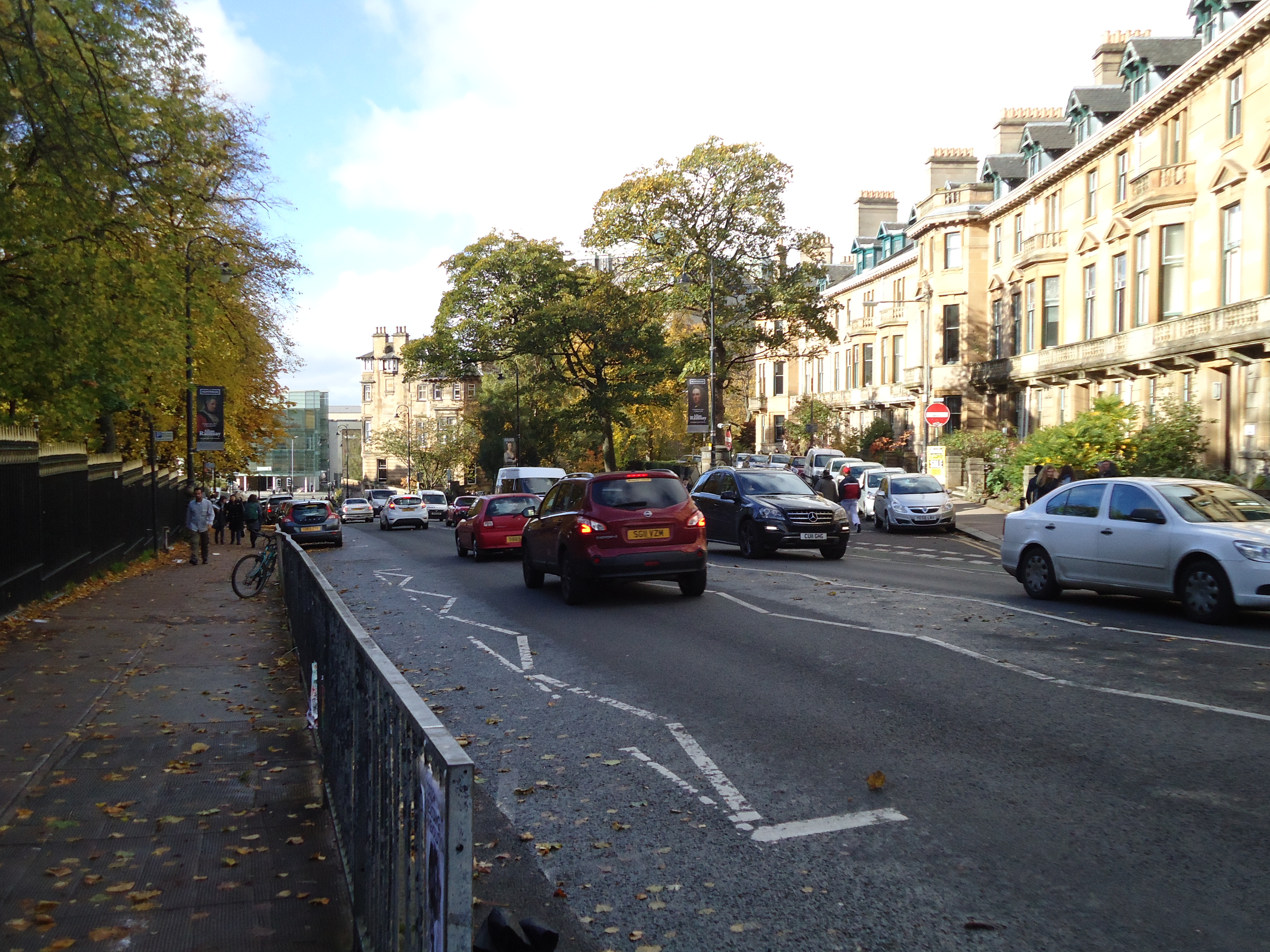
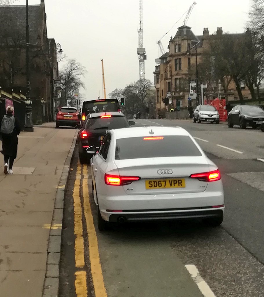
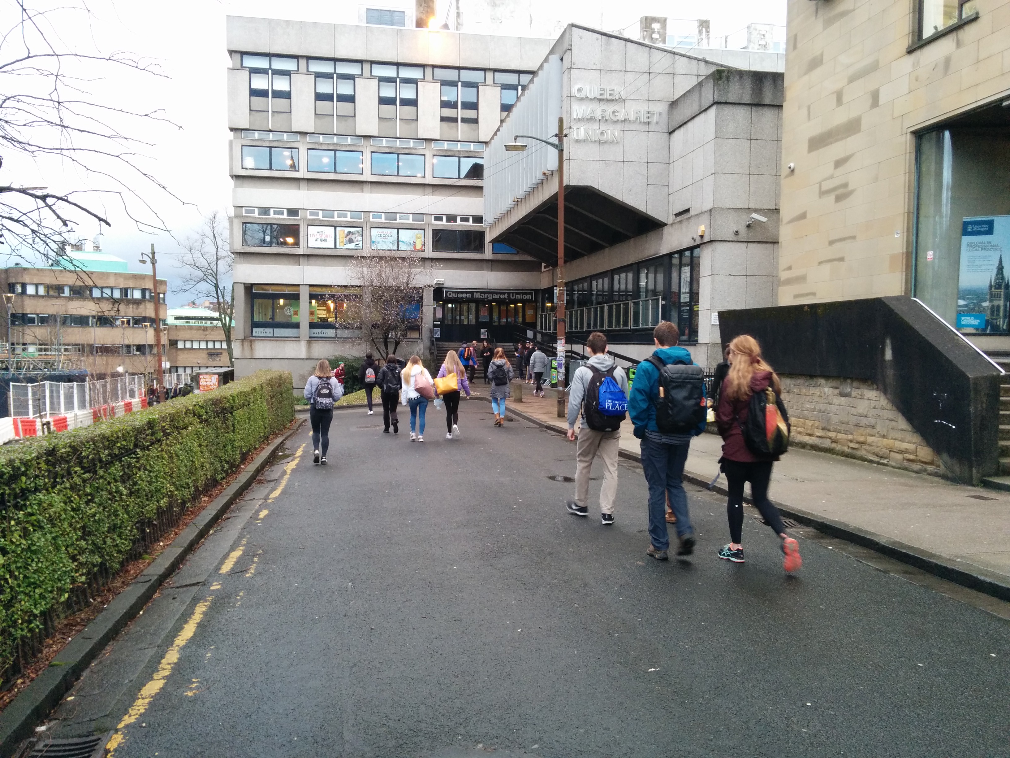
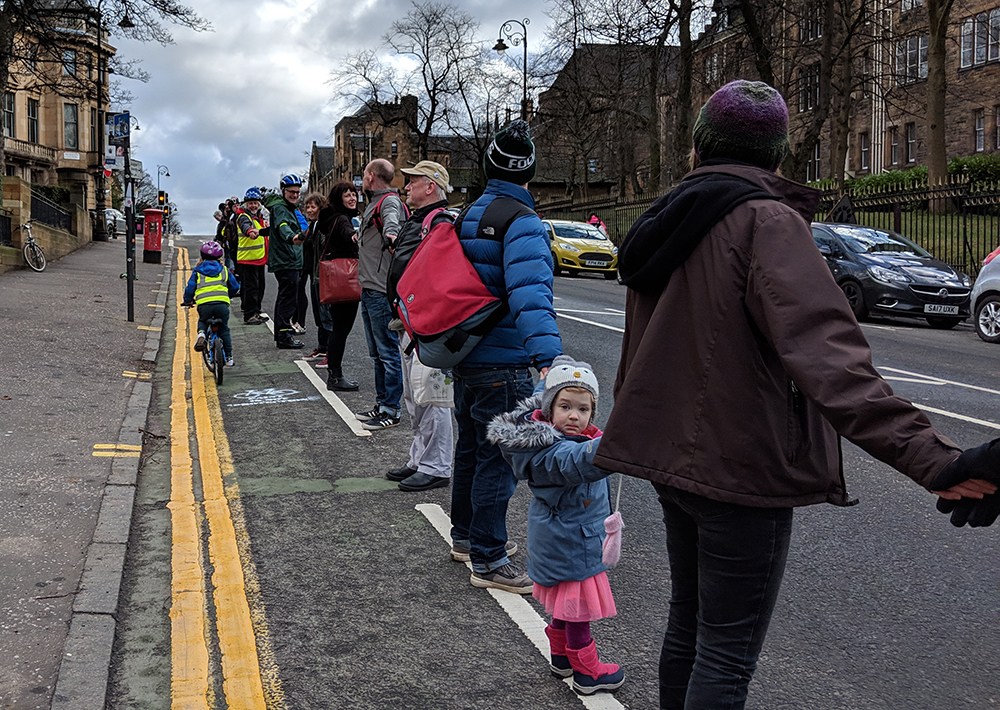
And yet the street remains functionally similar to how it was – a motor traffic through-route. This is often done as excess motor traffic is considered an assumed feature of city life, without explicitly being said so. But it’s worth knowing the cost it comes at.

New road layout on the right

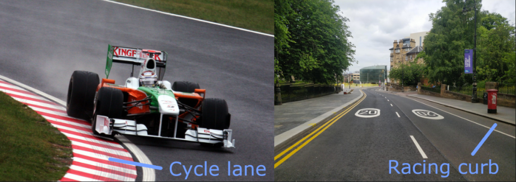
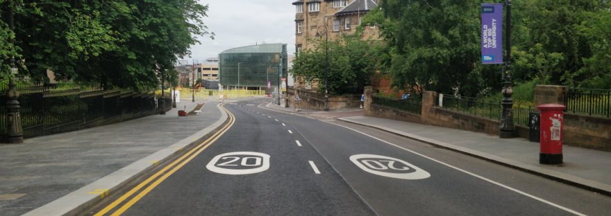
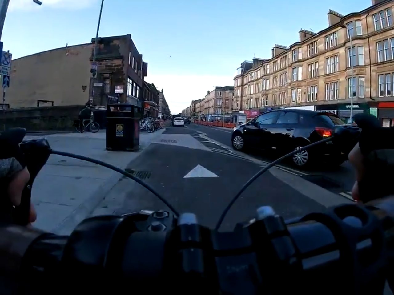
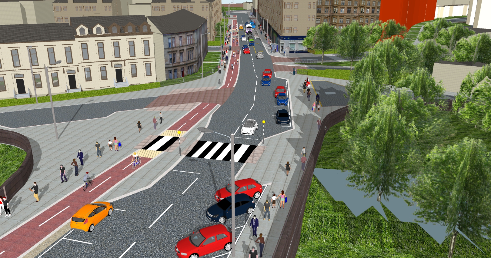
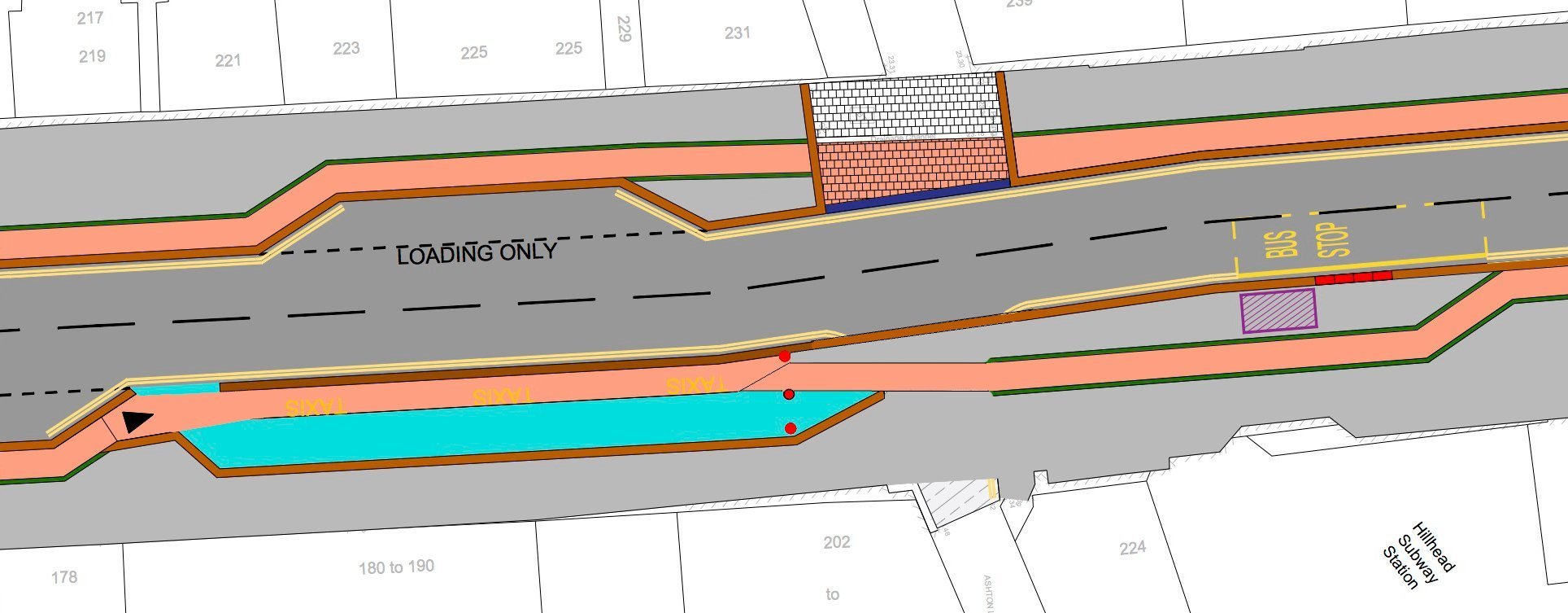
The speed limit says 20 mph, the physical layout says twice that. The painted cycle lane gives width margin for motor vehicles to go faster, rather like white and red curbs on a race track. We’re understandably expecting some people to escape this by cycling on the widened pavements.

There is nothing to stop vehicles from stopping and blocking the painted cycle lanes, just like before.

The University does have local access routes allowing you to cycle to and through the campus grounds. However a cycle network consists of a dense network of routes, including both local access roads and direct main roads. This ensures people have direct and convenient routes to get them to the places they need go.

University Avenue is an essential route in such a network, connecting east-west and Kelvingrove park, but is currently not accessible to many.

Worth Talking About

Kelvin Way was closed to motor traffic at the start of the pandemic and it has become a street of music, children playing games and learning to ride their bikes. Not something that was possible before. The two parts of the Kelvin park are now united into one safe and pleasant place for people to enjoy.

Before – difficult to cross busy road (Google Maps)
After – the unimaginable happened here!

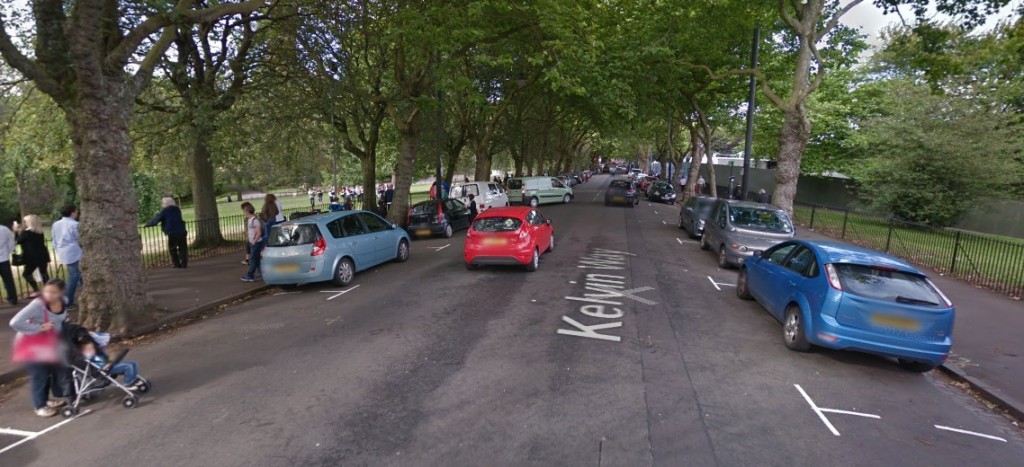
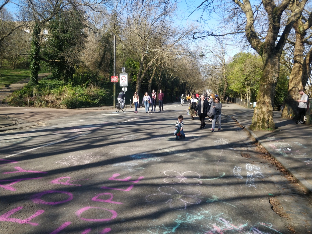
Kelvin Way shows a clear demonstration of the benefits of removing motor traffic, it took a pandemic to do the unimaginable. Can more imagination be applied to University Avenue?

So how do we fix University Avenue?

Broadly speaking there are two ways of improving the safety and accessibility of cycling with respect to motor traffic:

  • You physically protect people cycling through segregation.
  • You remove most of the motor traffic.

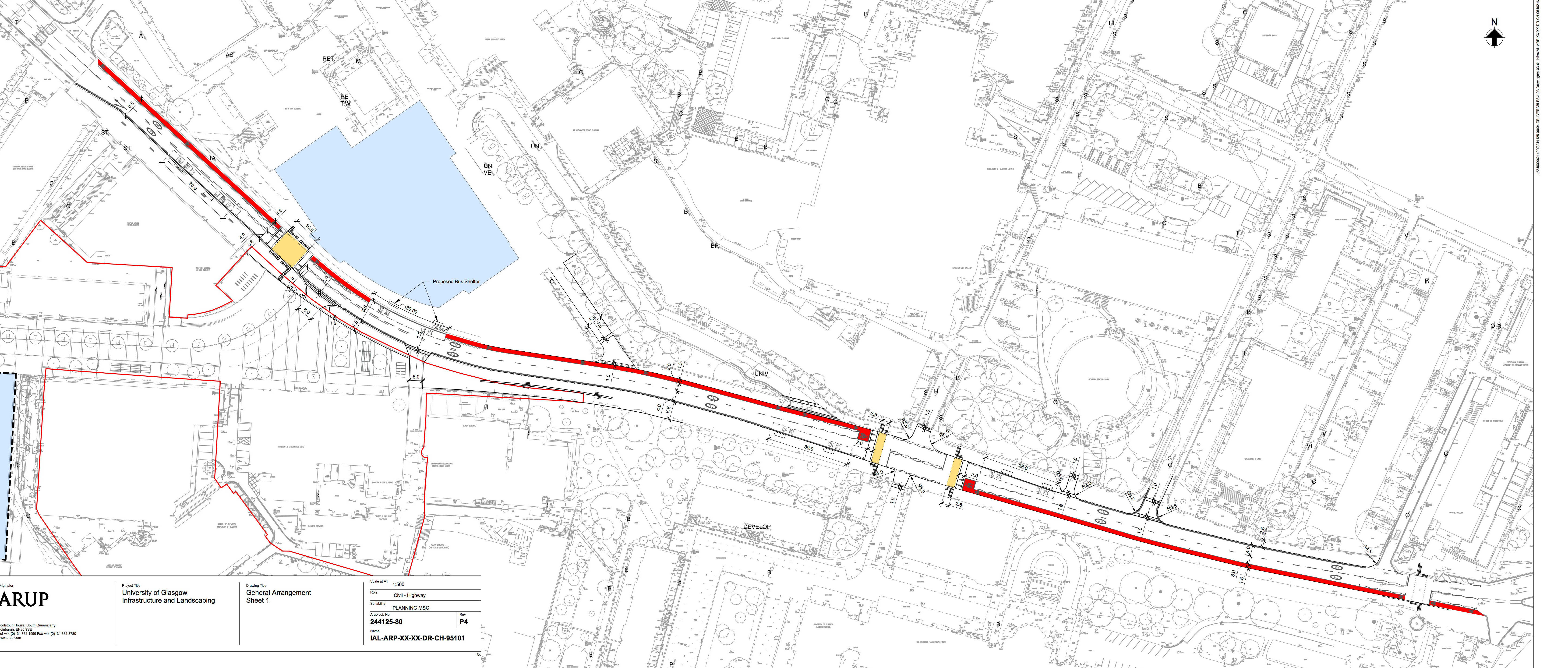
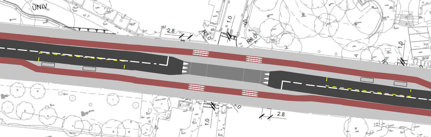
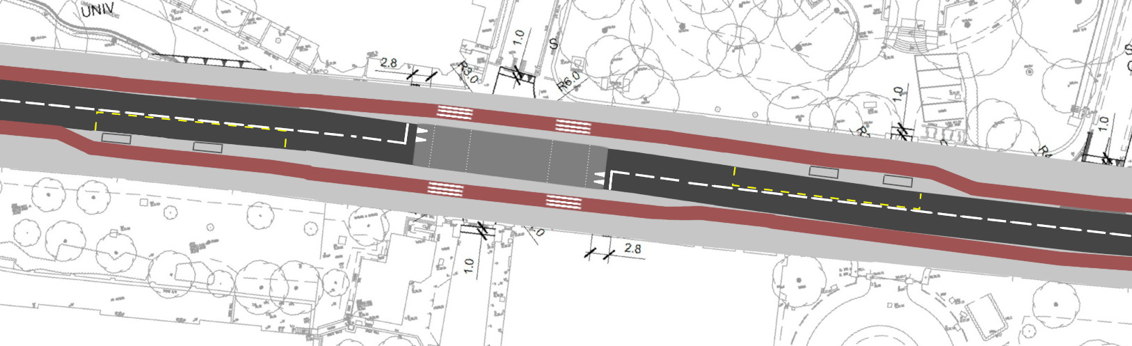
In the case of University Avenue, the tarmac has already been poured, so removing through traffic is the realistic option. Bus gates are a good way of doing this.

Gorbals St bus gate (University Avenue has less buses)

By restricting the type of vehicles that can go through the gate, it makes the road much quieter. People on buses don’t get stuck behind traffic, anyone riding bikes can enjoy a less stressful street and it is easier to cross the street. This could reunite the two sides of the University campus together much more effectively.

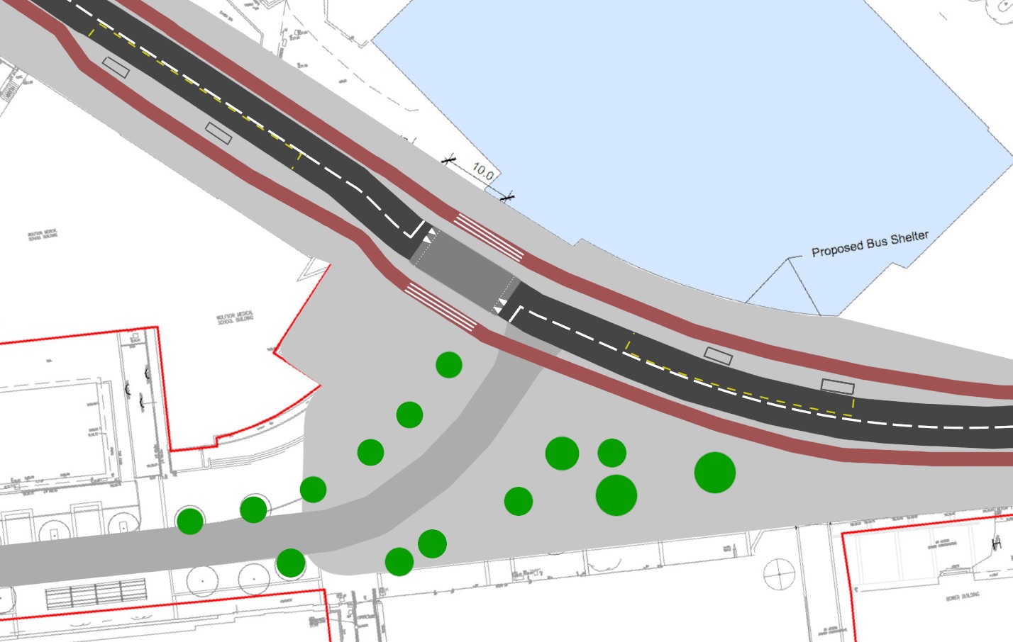
We could take the concept further and have average speed cameras with a very low limit, such as 10 mph. Bus number plates can be whitelisted to keep fast timetables, but anyone wanting to use the campus as a fast shortcut will be strongly discouraged. Anyone needing to access the campus with their vehicles to do deliveries or have other business can still do so without issue.

Red line – buses, access vehicles, deliveries & cycles only allowed
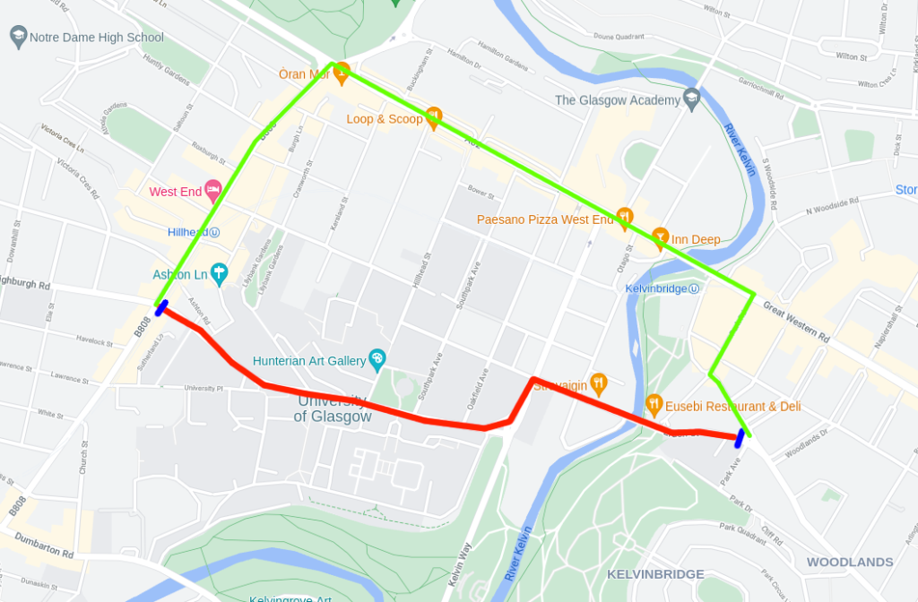
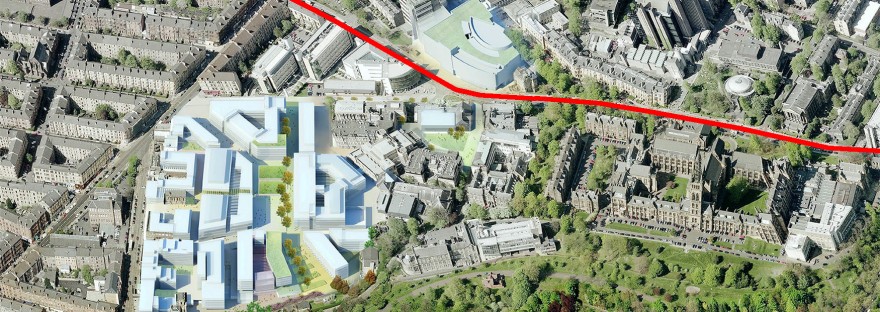
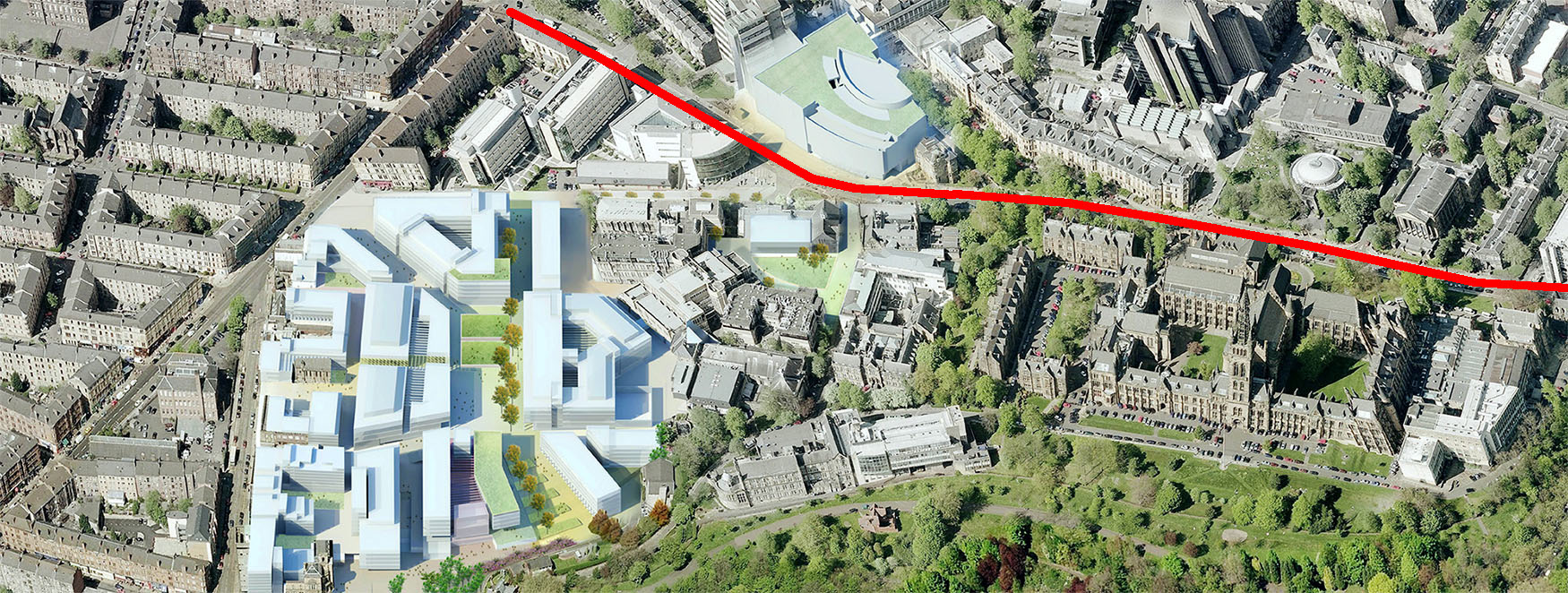
Green line – alternate route for other traffic
Blue – bus gate

If average speed cameras were placed at the junction to Byres Road and Eldon Street, it covers the university campus but still provides options to bypass the area.

With the substantial reduction of motor traffic the street becomes “nearly car free” and the road surface can be updated to reflect this.

Cars as guests

Conclusion

University Avenue remains an essential route in Glasgow’s developing cycling network. However the completed construction works have failed to make this a priority. Bus gates can salvage this situation so that we can realise the benefits that are currently being overlooked.

Event, Info

Final Plans for Byres Road

The final plans for the Byres Road public realm improvements have been released! We’ve come a long way since the first consultation in 2017, where we expressed our disappointment and frustration at designs that were simply maintaining the status-quo. Then in 2018 further designs were published that were similarly lacking ambition and accessibility.

After considerable push-back there was a serious rethink of priorities and we’re pleased to say the latest plans are overall a big improvement on what was on offer before and we’re encouraging people to show their support!

TRO plans – cycle paths in orange (click to enlarge)

In summary the new plans include space reallocation to segregated cycle paths and limited placemaking. The road will remain open to private motor traffic but those cycling and walking will not have to mix in with it! Bus stops have been improved by being on the carriageway and the south end is to be a one-way system. All with 20mph limits.

A more detailed description of the plans is given below. Including ways they can be made even better.

The plans are part of 3 separate Traffic Regulation Orders (TRO):

1 Traffic Management and Parking Controls

Major street changes – cycle paths, changing parking, double yellow lines, bus stops etc

ByresRoadTRO@glasgow.gov.uk 
2 20mph Speed Limit Zone

Byres Road, Church St and part of Highburgh Rd

ByresRoad20MPH@glasgow.gov.uk 
3 Hillhead Traffic Management and Parking Controls TRO

Change parking permit system to a shared-use controlled scheme – allowing for more spaces to be used more often. Officially pedestrianise Ashton Lane.
HillheadTRO@glasgow.gov.uk 

To show your support to any or all TROs, email the relevant email address above (you’ll need to include your full home address when emailing). You can read our pre-TRO feedback here.

There is also a public drop-in information session at Hillhead Library from 2pm-6pm on Thursday 6 February. So this is a good chance to talk to the designers about any questions you have.

Full details of each TRO.

Cycle Paths

The plans include segregated cycle lanes the length of Byres Road and one-way on Church Street, physically separating people from motor traffic. The paths are one-way on each side.

The cycle paths will enable people of all ages and abilities to cycle on Byres road without fear of motor traffic.

Cycle paths with bus stop bypass (this is good!)

The cycle paths are at pavement level but at the time of writing it’s not clear how the cycle path will be delineated from the pavement. We would want a very clear indication between cycle path and pavement, this is particularly important for visually impaired people and removes ambiguity for those not used to cycle paths.

A good example of delineation in Leicester – kerb, colour and texture:

1-way System

The south end of Byres Road and Church St is to be a 1-way system for motor traffic, but 2-way for cycling. Motor traffic coming down Byres Road will need to use Church St to access Dumbarton Rd.

Reducing two lanes of motor traffic to one offers a substantial improvement in the quality and safety of the street. It’s easier to cross the road, there’s less noise and pollution, slower speeds with a narrower road and larger pavements. It also maintains a lot of parking on these stretches of road.

Motor traffic -red
Cycle traffic – green

Junctions – cycle gates

Junctions pose significant risk to people on cycles. It’s important to separate people in both space and time to prevent dangerous interactions with motor vehicles.

The current proposals are using cycle gates. Cycle gates are similar to the current Advanced Stop Lines but with a signal controlling access to the bike box from the segregated bike path. This video example from London shows how it is supposed to work. It does mean when using the cycle path, you’ll always encounter 1 red light.

The other feature is an advanced signal for people cycling – not in the plans but have been told. There is an existing example already in Glasgow (note the 4th signal on the far set of lights). It turns green before the general traffic signal, giving a head-start to those cycling. If you like the idea of this extra signal, do say in your email to the TRO.

This is not our ideal junction design. You are guaranteed a red light and you have to position yourself ahead of motor traffic. Our own designs were based on proven protected Dutch junctions that largely avoid these issues.

Taxi Rank

The existing taxi rank has been kept in the plans, shown in turquoise. It will have a rising bollard to enforce the operational hours. The taxi rank crosses over the cycle path to let passengers directly access the pavement but it creates potential conflict at the crossover. There is also ambiguity as to who has priority at the side road and taxi entrance and exit.

Improved design here

It is not clear if the bollard system will prevent taxis from overspilling the rank and blocking the bike path. The bollards could even block the bike path depending on how they are implemented.

None of this addresses the noise problems to local residents from the taxi rank and the air pollution. While taxis do provide a useful role for certain journeys, it is questionable whether this is the best place for a taxi rank. We think the priority of the cycle path should be clear as is discussed next.

If you share these concerns, please add it into your TRO response.

Side Streets

This is the weakest part of the plans – the pavement and cycle paths are broken at side roads.

Chancellor St – pavement and cycle path interrupted by ambiguous crossing space

We already have experienced the consequences of this type of design in Glasgow. From the completed parts of the South City Way, drivers are failing to give-way when crossing the cycle path. This is likely because the road layout and surfacing give visual priority to drivers, even though markings say otherwise.

Car turning across cycle path on South City Way when should give way (@tcornwallis)

It’s really important to have the road environment communicate priority through design. Continuous pavements and cycle paths are a good way of doing this.

Recommended changes:

Left: continuous cycle path and pavement. Right: Additional tactile paving.

While adding tactile paving will be useful for visually impaired people to know where the side road is, having large visually contrasting surfaces will reduce the visual priority of the junction and could be counterproductive to its safety.

This is how it could look:

Dutch side road with continuous pavement and cycle path – you drive over pavement and cycle path – Robert Weetman

Dutch Side road with car leaving – Mark Treasure

We’re still in discussion with the designers and will continue to push for continuous pavements and cycle paths at the side road junctions.

Part of the Bigger Picture

A cycle network is comprised of a grid of connected routes, taking people directly and safely to where they need to-go. Byres Road forms a very important route in the development of such a network; allowing people to leave and arrive by this compact and low impact form of travel. The proposed plans help make this a reality we can all benefit from.

Make your views known by emailing your comments and attending the drop-in session.

Co-written with Iain Longstaff

Info

Avenue of Opportunity

Campus Expansion

Big changes are happening at the University of Glasgow. They’re expanding their campus to encompass the recently vacated adjacent hospital site,

Building a campus fit for a world changing university

This includes the street that bisects the campus, aptly named University Avenue: “…to make University Avenue a safer and more user-friendly environment

UoG_satelite_plan_marked
Campus Expansion, University Avenue (red) – University of Glasgow

Current Conditions

Despite this street’s name its function is to predominantly move motor traffic through the campus. A consequence of which was felt last year when a student was killed at one of the crossings; people frequently need to cross campus.

DSC03291
Dominant force – motor traffic

Those cycling face the danger of mixing with the streams of motor vehicles. Often encountering parked vehicles in the narrow cycle lanes. Suffice to say it’s not a pleasant experience and you can find yourself in dangerous situations.

2019-03-11_Eachann_many
There’s a cycle lane under there (Eachann Gillies @f0rmat)

It’s an important route for cycling. Connecting Kelvingrove Park with the University and Byres Road, and it also forms part of the wider Colleges Cycle Route. Simply it’s the most convenient route for many destinations.

Presented Plans

The actual plans are to remove parking, apply 20mph limits, narrow the carriageways with larger pavements and make changes to the crossing points. To the University’s credit, these are improvements, however, the provision for cycling is to remain very much as it is now – painted cycle lanes on the uphill sections. This is a street that remains functionally very similar to what it is now.

general_arrangement_merged_crp_cmp
Looks familiar

A Question of Function

The plans are trying to-be everything: through-route for motor traffic, good for cycling, placemaking and a University street. And as often happens, cycling is ‘compromised’.

A tenant of good street design is mono-functionality. What’s the primary purpose of this street? As with Byres Road, there’s broadly 3 approaches that could be taken:

  1. Placemaking – pedestrianise with cycle access
  2. Bus gate – buses, cycles and local access only
  3. Through-route – very limited place-making, segregated cycles lanes required

The volume of motor traffic largely constrains the function of a street; placemaking is severely limited in an environment dominated by vehicles. Expensive paving does little to mitigate this.

1. Placemaking

Aspirational people places where movement happens at human speeds, can be considered placemaking. A destination in as of itself.

2019-02-18_people_walkingCarriageway
Closed road on University Gardens – accidental placemaking

2. Bus Gate

Install bus gates to restrict access to buses and local access. Less private motor traffic getting in the way of buses will improve bus times and remove much of the street danger.

TopCrossing-1way_CRP
With less motor traffic comes greater placemaking space

3. Safe Through-Route

University Avenue is currently a through-route for all motor traffic. If it’s to remain as such then people cycling need to be separated from this danger. Rarely do you cycle at 20mph.

TopCrossing-Alternativev2
Protected cycle paths


WestCrossing3
University Place Junction

Our Future

Inviting motor traffic through the university campus harms the street environment and its users. Motor vehicles bring noise, toxins and danger, requiring traffic signals and protected cycle paths to keep others safe.

The University of Glasgow has made public statements committing to a sustainable future and to “minimise its impacts associated with travel”. It has an unparalleled opportunity to enable its users to take more sustainable form of transport in its very own backyard.

The sort of University Avenue we build today will be judged by its future users. Let’s give them something good to say.

2019-02-10_humanBikelane_childLooking

Info

Keeping up with the Future

Going South

The West End of Glasgow is changing. To the south of Byres Road works have already started on the massive Glasgow Harbour development. The 74 acres site will be the

… next generation of outlet destination by delivering a balanced combination of exciting leisure and entertainment with a strong retail offering.

Jason Pullen, Peel Lifestyle Outlets’ Managing Director

2018-08-15_artists_impression
Big competition for Byres Road

Easily accessible by car, so how can Byres Road compete?

Playing to your strengths

The strength of Byres Road comes from it being embedded in a community of people living, working and studying. It has its own unique character and sense of place through its architectural style and eclectic range of shops. A street that does a bit of everything for everyone.

However it’s currently suffering. The street environment is dominated by motor vehicles passing through, most of which don’t stop to shop but instead just bring noise, toxins and danger. Harming the street environment and its potential customers.

By reducing motor traffic to a minimum, either via pedestrianisation or bus gates, a more welcoming place can be enjoyed by all. We can make Byres Road safer for everyone and make it better than ever.

How do we get there

The damage caused by motor vehicles coupled with the difficulty in parking them, makes driving a limited and costly choice. And many of these trips being made by car are short journeys which could be made by more appropriate and less harmful forms of transport.

This is where cycling comes in. It allows us to significantly increase the Byres Road’s custom catchment area.

ByresRoad_customCatchmentArea

For people to even consider cycling, it needs to be safe and convenient. Currently on Byres Road people are expected to mix with motor vehicles when cycling which is not an option for most of us. It’s therefore important to create a safe cycling environment whether we have through traffic or not.

Left Behind?

Byres Road is not unique in facing the challenges of a modern high street but it could be left behind other streets which are embracing active travel. Here are some notable examples of streets realising the potential from cycling.

QMD_Opt_2_facing_N
Plans for Queen Margaret Drive

20181117_143638
Sauchiehall St cycle path along an avenue of trees – living street

20181117_150333
Victoria Road

Byres Road needs to identify the true causes of its problems and enable low impact travel alternatives to compete with internet sales, shopping malls and to truly flourish.

Info

You have been heard!

The findings from Byres Road’s June consultation have been published and an overwhelming number of people responded calling for better cycling provision,

Concerns about the quality of the proposed cycle infrastructure was the most common issue raised by participants (43.6%). Concerns related primarily to the lack of physical segregation and risk of conflict between cyclists and buses, parked cars, taxis and vehicles accessing loading bays. A number of respondents felt that cycle infrastructure could be improved through further reductions in parking and relocation of the taxi rank.

and reduced motor traffic!

A significant number of respondents (28%) felt that the scheme should be doing more to reduce the volume of traffic on the street including many who favoured complete pedestrianisation. In contrast 5% were concerned that the proposed changes had the potential to increase congestion or divert traffic to residential side-streets.

It’s great to hear so many have responded to lacklustre proposals by calling for a people-friendly Byres Road! However, now is the time to push your local councillors into taking these findings seriously to create a Byres Road where people are put first.

Our support page has the contact details of the councillors local to Byres Road. But it’s not just the local councillors who have a say in the future of this street but a committee of many councillors. We urge you to reach out to your councillors to get your views known.